|
www.shejapan.com > World Heritages > Three Parallel Rivers of Yunnan Protected Areas
Quiz:
|
|
|
|
< 青山学院大学 経済学部 経済学科 高野江利子 >
2. What country does Three Parallel Rivers of Yunnan Protected Areas adjoin?
Inscribed :2003 Criteria: (vii)(viii)(ix)(x)
Brief description:
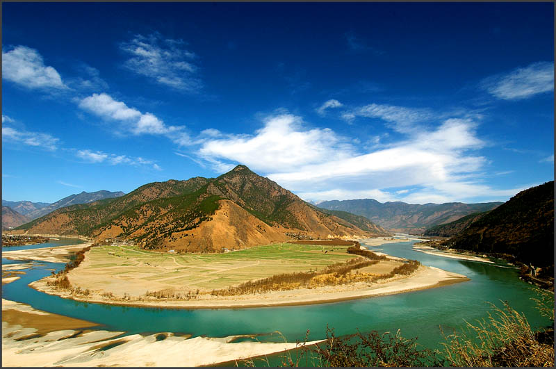
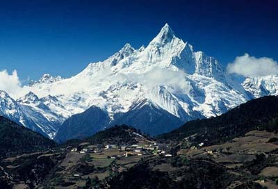
Consisting of eight geographical clusters of protected areas within the boundaries of the Three Parallel Rivers National Park, in the mountainous north-west of Yunnan Province, the 1.7 million hectare site features sections of the upper reaches of three of the great rivers of Asia: the Yangtze (Jinsha), Mekong and Salween run roughly parallel, north to south, through steep gorges which, in places, are 3,000 m deep and are bordered by glaciated peaks more than 6,000 m high. The site is an epicentre of Chinese biodiversity. It is also one of the richest temperate regions of the world in terms of biodiversity.
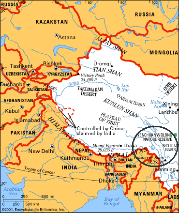
 Three Parallel Rivers of Yunnan Protected Areas is situated in south-west China. The site consists of 15 protected areas (in eight geographic clusters) in the mountainous northwest of Yunnan Province. The western and northern boundaries of the site border Myanmar and Tibet, in the high Hengduan Mountains (that comprise a large proportion of the nominated area), approximately 320km northwest of Kunming.Three Parallel Rivers of Yunnan Protected Areas extends over a total area of 1,698,400 ha, encompassing the watershed areas of the Yangtse (Jinsha), Mekong (Lacang) and Salween (Nujiang) rivers. The site extends over 8 counties and 3 perfectures and is composed of 8 principal sub-land areas totalling 1,698,419 ha.
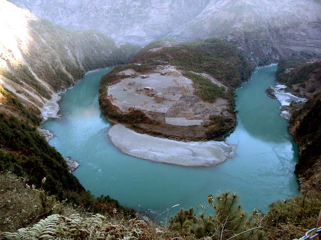
Bordering the Yunnun-Tibet border in the north, the Yunnan-Sichuan border in the east, the Sino-Burma border in the west, the site encompasses large sections of three of the great rivers of Asia, the Yangtse (Jinsha), Mekong (Lacang) and Salween (Nu Jiang), which run parallel from north to south through the nominated area for over 300km. The rivers pass through steep gorges, in places up to 3,000m deep. At their closest the three gorges are 18 and 66 kilometres apart, and for 70 kilometres there is a fourth parallel river on the western edge, the Dulongjiang, which runs into Myanmar, with west of it, the Dandanglika range. The Mekong runs through a gorge 310 km long.
The site is dominated by a huge composite orogenic belt that shows the signs of powerful crustal movements in the past. Notably the compression of the edge of the Eurasian plate by the underlying Indian plate which is being subducted along the line of the Lancang River fault. The resulting squeeze created vast thrust-nappes, violent shearing and uplift into high mountains (Hengduan Mountains and the uplift of the Qinghai-Tibet Plateau), through which pre-existing rivers continue to cut, resulting in the extreme vertical relief which characterizes the area.
Cultural heritage of the estimated 278,329 people living within the boundaries of the site, 13 ethnic groups are represented, among them the Tibetan, Yi, Naxi, Bai, Lisu, Pumi, Nu and Dulong peoples. Many of these ethnic groups preserve unique customs and traditions. In many areas of the National Park, villages containing traditional houses and terraced hillside farms well adapted to their environment are maintained. The management plan developed for the nominated area, urges government agencies responsible for management of the site, to develop action plans to preserve the cultures and traditions of such ethnic groups. The government intends to preserve 31 of these traditional villages, to realise their potential for tourism.
本文引用:UNEP
:unesco-Brief Description
Notes
Yunnan
雲南省
the Yangtse River
長江(中国最大の川。揚子江。金砂江)
the Mekong River
メコン川(瀾滄江)
the Salween River
怒江(サンウィン川上流部)
Kunming
麗江
gorges
渓谷
edge
(物の)縁
orogenic
造山運動の
Eurasian plate
ユーラシア大陸
Indian plate
インド亜大陸
altitude
標高
extreme
極度の
terraced hillside
段畑
ウェブテキスト作成は、とても大きな経験となりました。うまく起動できず、試行錯誤を繰り返し、パソコンと長時間対面していました。私は、パソコンが苦手なので、とても苦労しました。しかし、自分の選んだ世界遺産について調べ、知識を増やすことはとても興味深く、楽しんで学ぶことができました。また、情報を集めるために、海外のサイトをたくさん見るので、本場の英語と向き合うこともでき、とてもためになる英語の勉強になりました。 長い間、この中国の雲南省三江併流保護地域群と向き合い、とても愛着が湧いています。そのおかげで、今、私が一番行きたい国は中国です。きれいな景色は、人々を感動させますが、この雲南省三江併流保護地域群は、そのなかでも壮大で、私たちに生物と地球の神秘を感じさせる場所であると思います。大昔、大陸プレートの衝突により、180度曲がった怒江の独特な地形は、やはり、人々を惹きつけるものです。そのため、観光旅行にもたいへん人気のあるスポットです。ツアーなども充実しているので、足を運びやすい場所だと思います。是非一度、訪れたいです。
Yunnan
wikipedia
トンパ文字
www.shejapan.com
> World
Heritages > Three Parallel Rivers of Yunnan Protected Areas
© Copyright(C) 2007, SHEJapan, Ltd. All Rights Reserved.